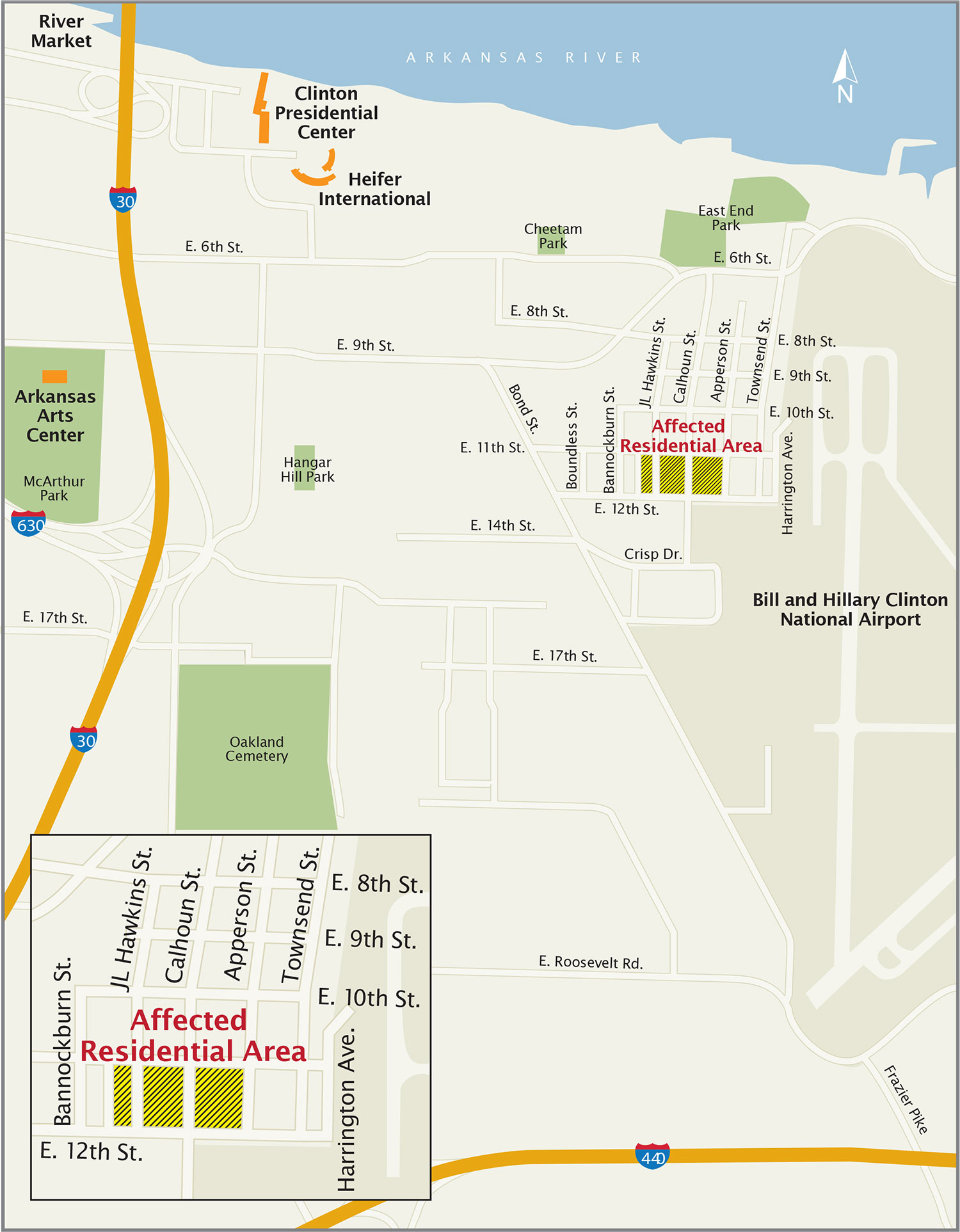
Affected Area
This map identifies the residential blocks affected by the former Timex site.
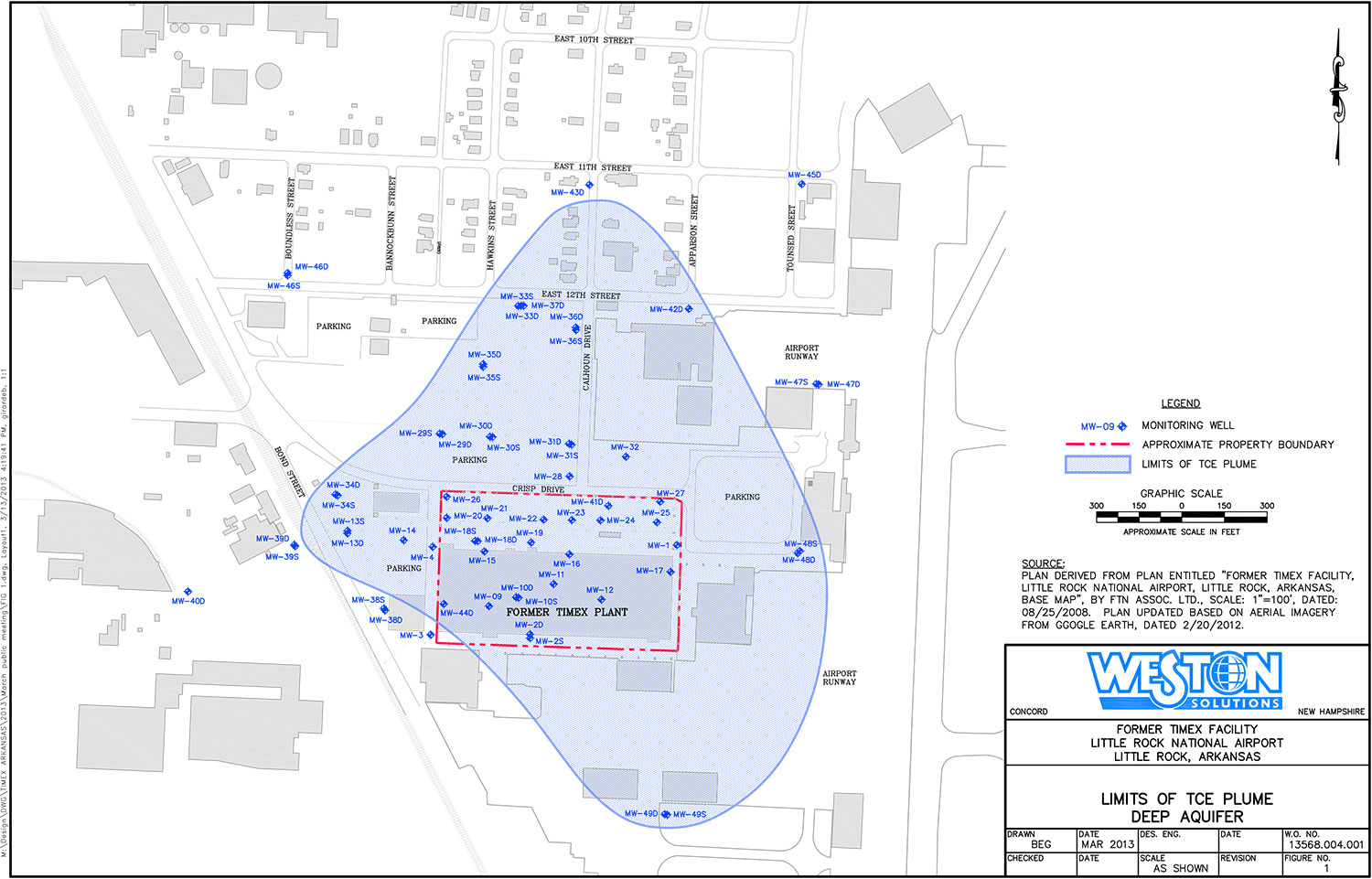
Deep Groundwater
This map shows the extent of the contamination in the deep groundwater, over 30 feet below the surface.
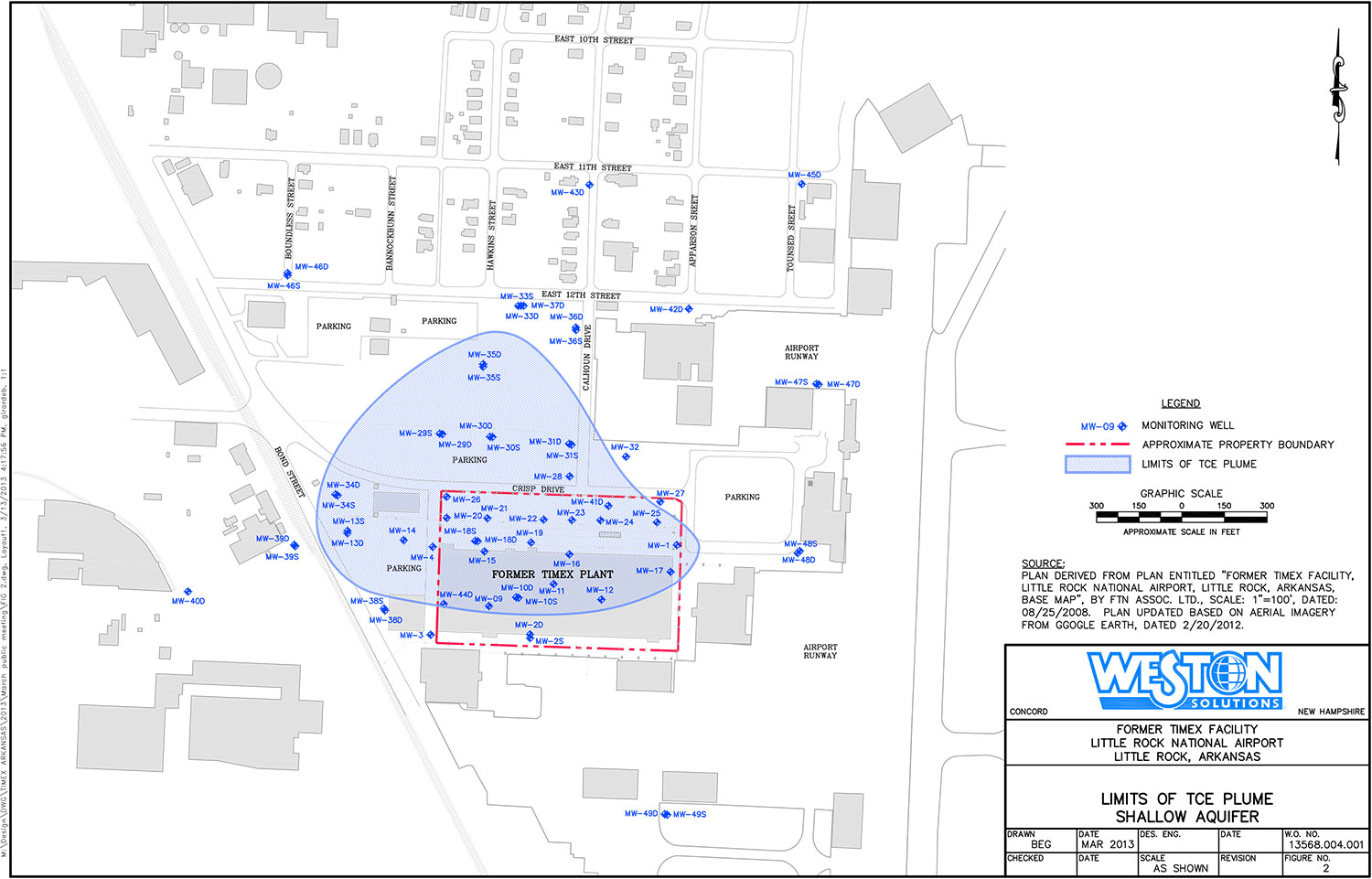
Shallow Groundwater
This map shows the extent of the contamination in the shallow groundwater. This contamination is located under the industrial properties south of 12th Street and does not impact the residential area.
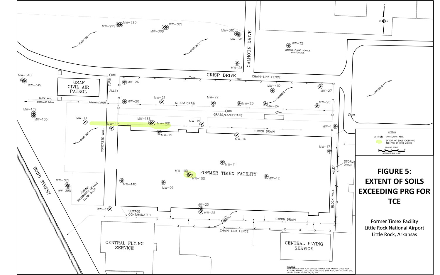
Soil
This map identifies the contaminated soil on the former Timex site. There is no contaminated soil outside the industrial area south of 12th Street.